Bollinger Road Project
-
Bollinger Road is the boundary between Cupertino and San Jose.
In July 2021 (during Covid-19 pandemic), the City of Cupertino generated Bollinger Road Corridor Safety Study. The report provided many safety suggestions and two alternatives.
- Alternative A includes a lane reduction on Bollinger Road, from two travel lanes in each direction to one travel lane in each direction and a two-way left-turn lane.
- Alternative B maintains the existing lane configuration of two travel lanes in each direction.
You can also see related information here.
San Jose Spotlight reported on 01/22/2024 that the project is set to start this (2024) summer.
Cupertino received external funding for this project. Cupertino needs to pay 20% of the cost for design.
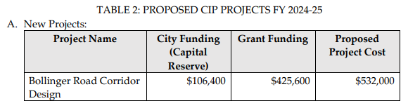
This project appeared as Low priority item on 03/19/2024 City Council study session.
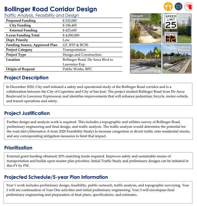
According to Bollinger Road Corridor Safety Study, the total cost for Alternative A is $11.7M, and the total cost for Alternative B is $10.5M in 2021. The project will be a five-year project. And total cost for Cupertino is estimated to be $4M.
During the public comment time, residents were split into two groups with one group supported Alternative A (lane reduction), while another group supported Alternative B (maintain lanes). Which alternative do you support?
Below are more details about Bollinger Road Corridor Safety Study.
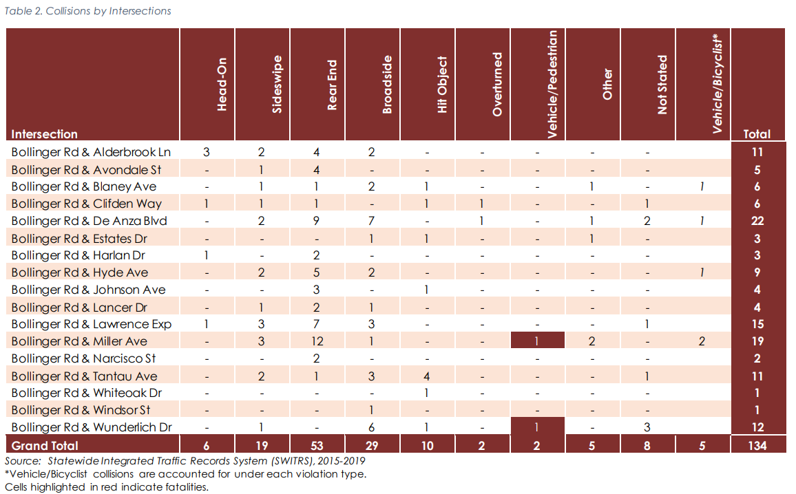
The study is a safety study with goals to "identify improvements to create a safer and more accessible corridor". According to the report, seems all the collisions happened at intersections.
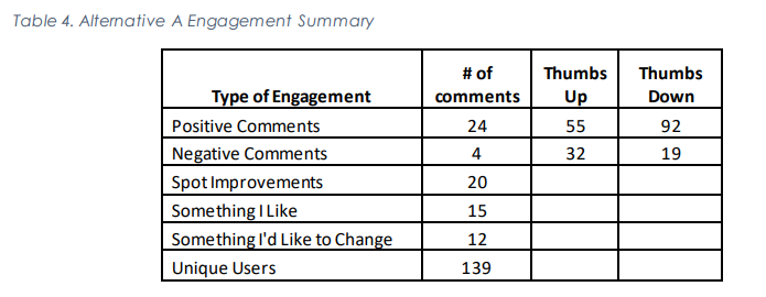
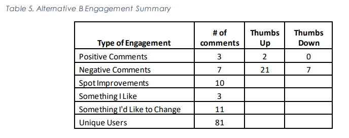
The study performed two surveys in March 2021 and May 2021, respectively. The March survey received 247 responses. While the survey in May had 139 unique users "VIEW" the maps. The report didn't mention how many responses received for the survey in May. The survey in May was about the two alternatives of reducing lanes and maintaining current lanes. Some residents reported they were aware of the survey in March, but they were not aware of the survey in May.
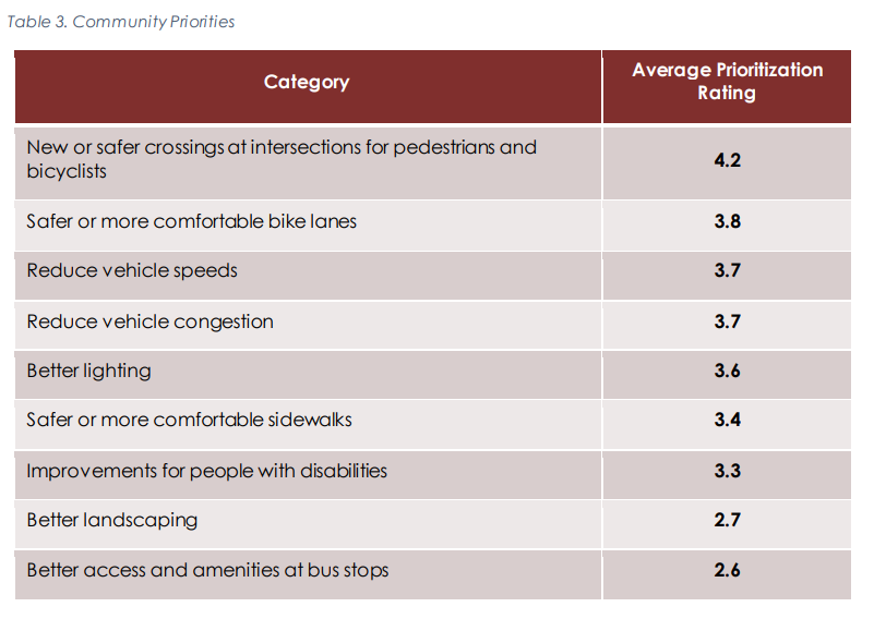
The results for the survey in March 2021 were:
The results for the survey in May 2021 were: